Services
Precision Survey & Mapping is a full service Professional Land Surveying Company. We offer a full array of surveying services with cutting edge technology to satisfy the many needs of a wide variety of industry groups. Entrust your next project, large or small, to the professionals at Precision Survey & Mapping.

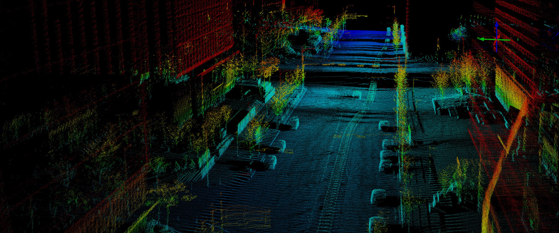
LIDAR SERVICES
Our LiDAR mapping services include aerial data acquisition from UAV, mobile acquisition LiDAR from vehicle mounted sensors, and terrestrial/land-based acquisition from Leica, survey grade scanners. With various processing software platforms, PSM can deliver in a wide variety of LiDAR and CAD formats. We possess Reigl and Leica LiDAR Sensors and are capable of delivering survey grade LiDAR Data for any application or project.
Photogrammetry
We have a strategic partnership with Synergy Mapping, Inc. to provide our large scale fixed wing photogrammetry. All of Synergy’s photogrammetrists are ASPRS-certified outfitted with the latest industry hardware and software technology.
We utilize in house UAV/UAS Mounted RGB Sensors for smaller scale projects, giving us the flexibility to mobilize quickly and deliver professional grade mapping and photography.
Clientele/Industry Groups
Municipalities/Governmental
PSM has been providing professional land surveying services to cities, counties, local governmental agencies and educational facilities across Colorado.
Corridor/Roadway
PSM has completed hundreds of miles of roadway corridor surveys for many different purposes including planning, utilities and civil engineering design.
Water/Wastewater
We have extensive experience delivering hundreds of miles of surveys for water and wastewater infrastructure projects.
Telecommunications
PSM has been working with Verizon, AT&T, T-Mobile, CenturyLink and Sprint to help build our nation’s high speed telecommunications networks.
Utilities Electric/Gas
We have extensive experience in support of electric utilities, including transmission and distribution. We have worked with Xcel Energy, Intermountain Rural Electric Association (IREA) and Morgan County REA on multitude of projects.
Solar/Renewable Energy
PSM has worked with Xcel Energy, JUWI Americas, Vestas and Intermountain Rural Electric Association (IREA) on many solar and wind projects, large and small. We are proud to support the clean energy sector with our professional efforts!
Commercial/Residential Development
We have a wide breadth of experience in support of Commercial and Residential Development. We have completed projects, large and small, for many General Contractors, including Kiewit, GH Phipps, PCL, SJ Louis and SEMA.
Real Estate Transactions
PSM has been providing Attorneys, Real Estate Professionals and Developers the ALTA Surveys they need to be certain their real estate acquisitions include all the facts necessary for a worry free transaction.