Geospatial
To compete in today’s fast paced world, it is essential to utilize the best technology available. At Precision Survey & Mapping, we believe in providing our team with cutting edge technology and software to enhance and optimize quality, timeliness, safety and productivity.
One of our keys to success is utilizing the best tool for each and every job. We utilize tried and tested technologies such as Trimble GPS, Robotic Total Stations and Dini Digital Levels as well as cutting edge technologies, including Mobile/Unmanned Autonomous Systems (UAS) LiDAR Mapping Systems and UAS/Aerial Photogrammetry Systems for our data collection.
MOBILE LiDAR
Mobile LiDAR is a cutting edge mapping solution that incorporates the most advanced LiDAR sensors, cameras and GPS receivers to collect survey-quality point data quickly and accurately. Mobile LiDAR offers numerous advantages over aerial mapping and conventional ground surveys. This non-invasive method of surveying can be operated at highway speeds, day or night, with efficient acquisition of tens of millions of points per minute. The sensors can be mounted on anything that moves including, aerial drones, motor vehicles, backpacks and watercraft, creating an extremely versatile means for collecting LiDAR Data.
BENEFITS OF LIDAR
AERIAL & Terrestrial LiDAR
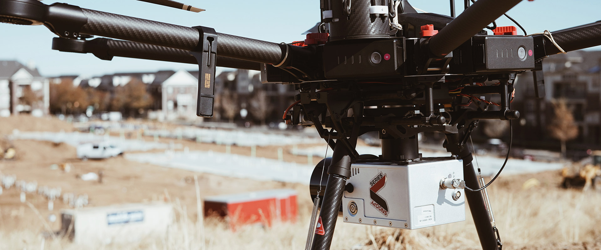
With State of the Art Mobile LiDAR, Aerial LiDAR and Terrestrial LiDAR Systems at our disposal, we are extremely well equipped to handle any Geospatial Mapping Project. After careful consideration of project specifications and terrain, the best suited sensor will be selected and utilized for each project. All of our pilots possess FAA Part 107-Remote Pilot Certificates, and are highly experienced in their field.
One of the biggest challenges of a fast moving technology such as LiDAR Mapping is determining the best feature extraction software available. Software developments are monitored regularly through internet searches and trade show attendance. Software is upgraded when deemed prudent so our clients can continue to benefit from new software developments.
We currently have two complete LiDAR USA “Snoopy” Systems and can deploy mobile mapping quickly and efficiently. We feature the Riegl VUX-1UAV Mapping Sensor capable of relative accuracies of 0.04’ when anchored to differential Ground Control Points (GCP’s). PSM has been using LiDAR technology since 2010 which positions us nicely for success with the fast growing technology.